
I went in the usual way. A beaten path skirting a farmer's field (the Knickerbocker area, and Knickerbocker Hill, are all named for this farm, which is still apparently in the Knickerbocker family) leads to the former railroad tracks, sometimes a dirt trail, sometimes a cinder trail. A few feet of it are paved where it joins Knickerbocker Road.
Here I am, looking back toward the invisible spot where the trail begins. On the horizon is the Knickerbocker Farm. I'm given to understand they aren't wild about people walking on their pasture, which I did once before I knew that. Now I am good. YOU HEAR ME? GOOD!

I turned the corner of the field and walked east toward the tracks, and saw white blossoms, which my camera didn't want to photograph. Well! Who's to be the master, here? I paid money for you, my fine photographic instrument! I boldly turned the wheel from Automatic to Manual for a walk on the wild side. I experimented with ISO and shutter speed today. So far I've been able to capture detail in darkness at the expense of losing all detail in the sky and some other bright areas.

By the way, these photos will enlarge if you click on them. Well, they do for me. Perhaps your set-up differes from mine in this way. How can you find out? Go on, give it a try. I clicked and adjusted my way along through a couple more turnings, and could see the cinders of the Auburn below me. One thing I like about this route, there's more up and down and the terrain is less regular. One thing I don't like: I think it's where I'm getting the majority of my bug bites these days.

I wasn't quite satisfied that my photo looking down captured the elevation change satisfactorily. Hitting the trail (not literally: I stepped on it), I turned around and tried the converse shot, looking back at where I'd come from. As advertised, this shot captures some detail while losing the blue of the sky. I might be able to get it back in Photoshop, or turn a darker shot to account, but for immediate gratification today, I'm dumping them all in just as I clicked them. The greens of the foliage seem to lose some of their yellow and tend toward blue. You should see the ones I threw away.

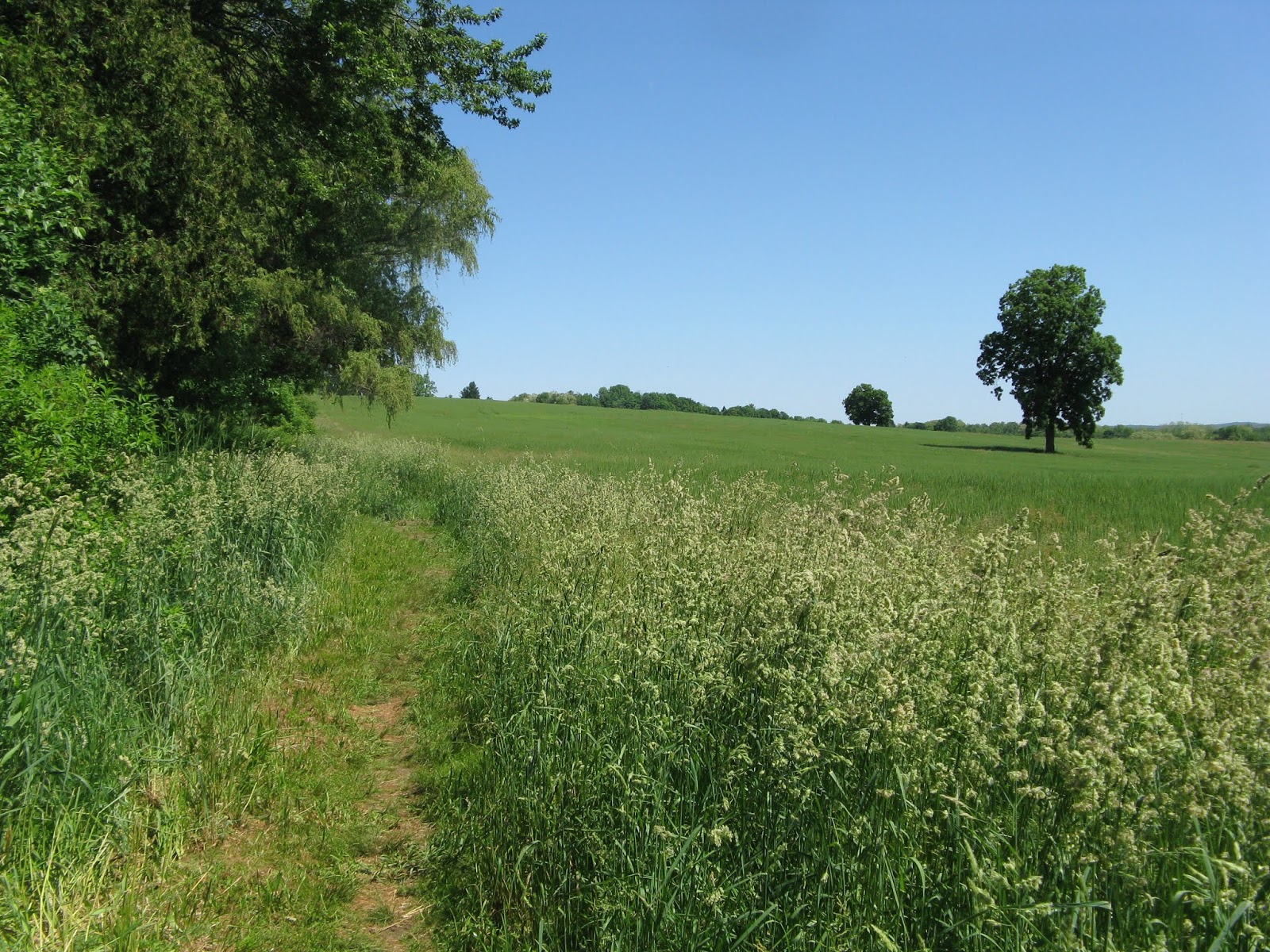
There we go. Captured the trail looking back, and the one that forks off if it.
THE ONE THAT FORKS OFF OF IT??

Holy George Gordon, Lord Byron, there's another path there, leading into the enticing thick of the woods that I could see from the crest of the previous path. Here was my chance to see something new, and I took it right away. It led through grasses and elbow-high shrubs with flowers and a dragonfly and a lovely dark butterfly way cooler than the little white cabbage butterflies I've been seeing back in (ptoo!) civilization. A creek I had never suspected in my twelve years here ran along quietly, easily accessed from occasional forkings of the path, and full of rocks to stand on.

I took photos that looked surreal when I got them home, some with rocks as green as the foliage, and many with what could have been the atomic flash of The Big One in the area outside the shade of the trees.

After all that, the path eventually led to a big flat area where it stopped being a path and became something else. A big patio, maybe. I returned to the railroad trail, where I saw a half dozen people in all as I made my way toward Knickerbocker and pavement again.

On the downhill side of the Auburn trail, the creek opened up into a gorge. There was also one upstream, come to think of it. I tried for a couple more shots, going portrait mode for this one. I'll preview this and see if I made it too big. I hope I can leave it this size.

I turned aside to capture the sorels. Is that the word? Tree mushrooms. A couple passed behind me while I did, and when I returned my attention to the trail, they had proceeded far past the point of pantomiming a hello through my mask. All through this, I'd been listening to Act III of Sullivan's grand opera Ivanhoe, and would have had to pull an ear bud out to communicate anyway.

Another view of the sprawling Knickerbocker farm, with its huge barn. The high ground here conceals a horse or two that might have been visible otherwise. I boldly took another side path as a shortcut to the road, but missed little of the steepest uphill part of the whole walk. I once saw a turkey coming out of the corn on the south side of the road and stopped and jogged back with my camera, but it was gone. Since then, I've looked for it two thousand times or more, and can report that it's still gone, "like a turkey in the corn."

Here, not far from the entrance to our neighborhood (through the subdivision built next to ours, and I believe more recently--Knickerbocker Hill, named for the hill named for the farm named for the Knickerbockers--dates to about 1965, and in the aerial photos we received along with this house, seems to have been the first thing put here) is the farm stand that sells corn grown in the fields on the north side of the road. They also sell other vegetables and eggs that they buy from other farms or, more likely, from a jobber who brings them stuff. Useful, sometimes, if you need a tomato.

The road leading into the newer (and ritzier) subdivision is a short avenue, with a median and everything. On the left is a rather nice house that I got to be in one time when an outgoing owner had a moving sale before returning to England. The downstairs had a room full of built-in cabinets that I, of course, envied.

Behind that fence, off the large back yard, this gazebo sits and looks out over the Knickerbocker fields to the rolling hills (are they Appalachian mountains? hmmm) and far horizon. I often wish I'd had the foresight to ask the outgoing owner if they'd mind me sitting out there for about a half hour while slowly sipping a glass of cold water. Missed opportunities (like not asking the owners of an enticing tree swing at the end of a private drive I used to see on bike rides around the Mariner's Park, back in Newport News)!

1902 map, I think. I see these plats here and there, usually for wall decoration, and usually when I only have my phone to take pictures with. It's instructive to see the progress over the years. Our subdivision seems to be the Blodgett holdings, but was expanded to include the Knickerbocker lands just south of them. Then the newer stuff came in on the James Stewart spread (didn't know he owned land here, did you? DID YOU?). Silco's place became another subdivision. Other patches were filled in (I guess) as patriarchs died and their families cashed in. East Road was moved somewhat around the turn of the century, which may be reflected in the map. You can see the railroad tracks. They crossed the canal on big cement piers that still stand, and I wish somebody'd built a foot bridge over them so I could walk the trail across the Erie Canal there. Oh, the places I'd go.
Since I'd done so much extra walking, I cut through Joe and Deb's yard, once I'd located their house. They're our back neighbors, living on a street of lovely individual homes which had some of the best trick-or-treating back in the days when I had a trick-or-treater in the family. As I got to our yard, I met them coming back through our yard (or our neighbor Bob's yard, which also backs onto theirs) and criticized them jovially for walking on other people's property, and they asked if I was the guy photographing the tree on the railroad trail. We chatted about trails and other possible complete circuits one might make by going right onto the Auburn instead of left, and caught up on where our kids were going to school and such.
A good day walking. Next time--Monday, most likely, as I take Sundays off--I think I'll take that right turn, and either walk on Mill Road, or follow the RR trail to Thornell and re-enter the neighborhood through one of several little paths that give shortcuts to Thornell Road Elementary and the houses near it (those houses take miles to drive to, but I can walk or ride right to them) or the high school (located in Clare Barker's old spread), or Thornell Farm Park (due south of Barker's).
.
2 comments:
I loved getting to go along on the walk! Looking forward to the path not taken!
I think your white flowers are blackberries. Long canes that arch and replant the tips. Sometimes.
Post a Comment